
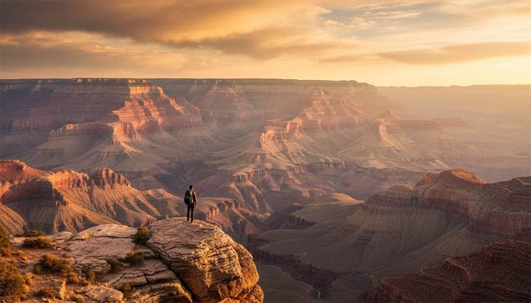
The Grand Canyon at a Glance
Before diving into the deep history behind the canyon, here's the quick picture — the numbers and facts that put its scale and significance in perspective before the full story unfolds below.
The canyon's exposed rock layers span an almost incomprehensible stretch of time, from ancient basement rock formed nearly two billion years ago to layers deposited a mere 270 million years ago — still ancient by any ordinary measure.
The canyon stretches along the Colorado River from Lees Ferry to Lake Mead, carved gradually over a comparatively recent stretch of that immense geological timeline.
At its widest points, the canyon spans distances that make the opposite rim barely visible, a scale that's difficult to fully appreciate until standing at the edge.
From rim to river, the canyon reaches depths exceeding a mile in places, exposing rock layers that would otherwise remain buried far beneath the surface.
Few places on Earth expose such a complete, readable record of geological history in one location, which is exactly why geologists and educators consider it one of the finest natural classrooms anywhere.
How Was the Grand Canyon Formed?
Understanding how the Grand Canyon came to exist is one of the most rewarding parts of visiting it — the story spans nearly two billion years and involves ancient seas, mountain-building, continental-scale uplift, and millions of years of relentless erosion, each step leaving its mark on the rock layers visible today. Reading that story doesn't require a geology degree — once the basic sequence of events is clear, the canyon's walls essentially explain themselves to anyone willing to look closely.
Ancient Seas
Long before there was a canyon, this region was covered repeatedly by shallow seas that advanced and retreated over hundreds of millions of years. Each time a sea covered the area, it deposited layers of sediment — sand, mud, and the remains of marine life — that would eventually compress into the limestone, sandstone, and shale layers visible in the canyon walls today. The repeated cycle of seas advancing and retreating is part of why the rock layers alternate in type and color rather than forming one continuous, uniform layer. Each advance and retreat left its own signature: limestone where the water was calm and deep enough for marine life to thrive, sandstone where beaches and dunes dominated, and shale where fine mud settled in quieter coastal shallows.
Mountain Building
Deep in the canyon's geological history, tectonic forces built ancient mountain ranges from the region's oldest rocks, subjecting them to intense heat and pressure that transformed them into the metamorphic rock now exposed at the very bottom of the canyon. Those ancient mountains have long since eroded away, but the deformed, altered rock they left behind — visible as the dark, twisted formations near the Colorado River — is a direct record of that violent mountain-building period nearly two billion years ago. The intense pressure involved actually folded and re-folded the rock in places, which is why the Vishnu Basement Rocks often show swirling, contorted patterns rather than the neat horizontal bands seen in the layers above them.
The Colorado Plateau
The Colorado Plateau is the broad, elevated region covering much of northern Arizona and neighboring states, and its slow, relatively uniform uplift beginning tens of millions of years ago is what raised the layers of rock thousands of feet above sea level. Unlike many mountain-building events elsewhere, the plateau rose largely as a single, stable block rather than folding and faulting dramatically, which is part of why the canyon's rock layers remain so remarkably level and easy to read today, rather than tilted or scrambled. Geologists still study exactly why this particular region rose so evenly compared to more tectonically chaotic regions nearby, and it remains one of the more actively researched questions in the canyon's geological story.
The Colorado River
With the plateau uplifted, the Colorado River gained the energy and gradient needed to begin cutting downward into the rock, carrying away sediment and slowly deepening its channel over millions of years. The river's course was likely influenced by older, pre-existing drainage patterns, and its continued downward cutting — helped by occasional floods carrying enormous volumes of rock and sediment — is the primary force responsible for carving the canyon we see today. Sediment and rock fragments carried within the river's flow acted almost like sandpaper, scouring the riverbed and accelerating the downward cutting far beyond what clear water alone could have achieved.
Millions of Years of Erosion
Erosion didn't stop with the river alone. Rain, wind, frost, and the slow but constant process of weathering have worked on the canyon's exposed walls for millions of years, widening the canyon far beyond the river's own channel and carving the dramatic side canyons, buttes, and temples that give the landscape its distinctive character. This ongoing erosion is why the canyon continues to change today, even if the changes are far too slow to notice during any single visit. Freeze-thaw cycles play a particularly important role along the rim, where water seeps into cracks in the rock, freezes overnight, expands, and gradually pries the rock apart — a slow, patient process repeated countless times each winter.
Today's canyon is the result of all of these processes working together across immense spans of time — ancient seas depositing rock, mountain-building and metamorphism at the base, regional uplift raising the plateau, and millions of years of river-driven and weather-driven erosion cutting downward and outward. No single event created the Grand Canyon; it's the product of nearly the entire span of Earth's geological history acting on this one place.
Why the Grand Canyon Is So Famous
The Grand Canyon's fame among geologists and scientists goes well beyond its size and beauty, though both certainly play a role. Its exposed rock layers function almost like pages in a history book, each one a distinct chapter documenting a particular period, environment, and set of conditions from Earth's deep past — stacked in order, largely undisturbed, and remarkably accessible for study.
That accessibility is part of why the canyon has become one of the world's premier natural classrooms for geology. Scientists studying ancient climates, oceans, deserts, and long-vanished environments can examine direct physical evidence here in a way that's rare almost anywhere else on Earth — evidence that would otherwise remain buried far below the surface in most other locations. Generations of geologists have used the canyon's layers to build and refine much of what's understood today about the deep history of the North American continent, and new research continues here even now.
Few other places on the planet combine this much visible geological history with this little disturbance. In most locations, tectonic folding, faulting, or vegetation cover obscures large stretches of the geological record, forcing scientists to piece together a story from scattered, incomplete evidence. At the Grand Canyon, mile after mile of exposed, largely level rock lays out an enormous span of Earth's history in a single, walkable cross-section — which is exactly why the canyon appears in geology textbooks worldwide, and why student field trips and professional research expeditions alike continue to return to it year after year.
Understanding the Rock Layers
Rather than one dense wall of undifferentiated rock, the canyon is made up of distinct, identifiable layers, each with its own age, color, and story. Here's what to know about each of the major layers, from youngest at the rim to oldest at the river — a sequence that, read from top to bottom, moves steadily backward through more than a billion years of Earth's history with every step down into the canyon.
Kaibab Limestone
The Kaibab Limestone is the youngest major layer in the canyon, roughly 270 million years old, and it forms much of today's South Rim — meaning it's often the very rock visitors are standing on at popular overlooks. It's pale gray to cream in color and formed from sediment deposited in a shallow, warm sea that once covered the region. Fossils of marine creatures, including sponges, corals, and shellfish, are occasionally found within it, a reminder that the rim's forested landscape today was once entirely underwater.
Toroweap Formation
Just below the Kaibab Limestone, the Toroweap Formation is similar in origin and age — around 273 million years old — having formed under comparable shallow sea and tidal-flat conditions. It's typically a pale yellow-gray and tends to form a more gradual, less cliff-forming slope compared to the layers above and below it, making it a bit less visually distinct to the untrained eye than some of the canyon's more dramatic layers.
Coconino Sandstone
The Coconino Sandstone, roughly 275 million years old, is one of the most visually striking layers, appearing as pale cream or white cliffs formed from what was once a vast desert of wind-blown sand dunes, similar to the Sahara today. Cross-bedded layering within the rock — diagonal lines visible in the cliff face — preserves the actual shape of ancient dunes, and fossilized reptile tracks have been found within it, offering a rare direct record of animal movement across those long-vanished dunes.
Hermit Formation
The Hermit Formation, sometimes called the Hermit Shale, dates to roughly 280 million years ago and formed from mud and silt deposited on an ancient river floodplain. Its reddish-brown color comes from iron minerals within the rock, and it's notable for containing some of the best-preserved fossil plants found anywhere in the canyon, including ferns and early conifers that offer a detailed look at the vegetation of that ancient floodplain environment.
Supai Group
The Supai Group, roughly 285 to 315 million years old, is actually made up of several distinct rock layers rather than one uniform formation, reflecting a period when the region alternated between rivers, coastal plains, and occasional shallow seas. Its banded red and orange coloring, created by iron-rich sediment, produces some of the canyon's most visually layered cliff faces, and it contains a mix of fossils reflecting that changing, transitional environment.
Redwall Limestone
The Redwall Limestone, about 340 million years old, forms some of the canyon's most dramatic sheer cliffs and was deposited in a warm, shallow tropical sea rich with marine life. Despite its name, the rock itself is actually gray — its vivid red color comes from iron-rich sediment washing down from the red rock layers above and staining the cliff face over time, a striking example of how the canyon's appearance is shaped by ongoing processes, not just the original rock alone. Because it forms such a prominent, continuous cliff band, the Redwall is often the single layer most responsible for making below-the-rim routes genuinely difficult, funneling hikers toward the handful of natural breaks in its otherwise near-vertical face.
Muav Limestone
The Muav Limestone, roughly 505 million years old, formed in a shallow sea and typically appears gray to gray-green, forming steep cliffs within the canyon's middle layers. It represents an early chapter in the sequence of marine environments that would eventually give way to the desert and river conditions recorded in the higher layers above it, part of the long alternation between sea, land, and desert recorded throughout the canyon's walls.
Bright Angel Shale
The Bright Angel Shale, around 515 million years old, formed along an ancient shoreline and is recognizable by its greenish color, resulting from the minerals present in the mud it was deposited from. It's one of the most fossil-rich layers in the canyon, containing abundant trilobites and other marine fossils that provide some of the clearest evidence of early complex life found anywhere within the canyon's walls.
Tapeats Sandstone
The Tapeats Sandstone, roughly 525 million years old, marks the beginning of the main sequence of Paleozoic rock layers and formed along an ancient beach as an early sea advanced across the region. Its brown color and coarse, sandy texture reflect that beach and near-shore origin, and it typically forms a prominent, resistant cliff band that's often one of the first major layers hikers encounter below the rim.
Vishnu Basement Rocks
At the very bottom of the canyon, exposed along the Colorado River, lie the Vishnu Basement Rocks — among the oldest rocks exposed anywhere on Earth's surface, dating back roughly 1.7 to 1.8 billion years. These dark, twisted metamorphic rocks formed deep underground under intense heat and pressure during ancient mountain-building, long before any of the layers above them were ever deposited. Standing at the bottom of the canyon and touching these rocks means touching material nearly half as old as the planet itself. Streaks of pink granite are often visible cutting through the darker Vishnu rock, formed when molten rock intruded into cracks in the older basement material and slowly cooled underground — a second, later chapter of geological activity layered directly into the very oldest rock in the canyon.
For a quick reference, here's how the major layers compare at a glance:
| Rock Layer | Approximate Age | Environment | Color | Fun Fact |
|---|---|---|---|---|
| Kaibab Limestone | ~270 million years | Shallow sea | Gray | Forms much of today's South Rim |
| Toroweap Formation | ~273 million years | Shallow sea & tidal flats | Pale yellow-gray | Similar in origin to the Kaibab above it |
| Coconino Sandstone | ~275 million years | Ancient sand dunes | Cream | Preserves fossilized dune patterns and reptile tracks |
| Hermit Formation | ~280 million years | River floodplain | Reddish-brown | Known for well-preserved fossil plants |
| Supai Group | ~285–315 million years | Rivers & coastal plains | Red-orange (banded) | Actually made of several distinct rock layers |
| Redwall Limestone | ~340 million years | Warm tropical sea | Gray (appears red from staining) | Creates many of the canyon's most dramatic cliffs |
| Muav Limestone | ~505 million years | Shallow sea | Gray-green | Forms sheer cliffs in the canyon's middle layers |
| Bright Angel Shale | ~515 million years | Ancient shoreline | Greenish | Contains abundant marine fossils |
| Tapeats Sandstone | ~525 million years | Ancient beach | Brown | Marks the beginning of the Paleozoic layers |
| Vishnu Basement Rocks | ~1.7–1.8 billion years | Ancient metamorphic rock | Dark gray/black | Among the oldest rocks exposed anywhere on Earth's surface |
The Colorado River
While uplift and ancient seas set the stage, the Colorado River is what actually carved the canyon as we recognize it today, cutting downward through thousands of feet of rock over the last five to six million years. That downward cutting was possible because the uplifted Colorado Plateau gave the river a much steeper gradient than it previously had, dramatically increasing its erosive power and its ability to carry sediment and rock debris downstream. Geologists sometimes describe the river during that period as working like a conveyor belt, continuously removing material as fast as tributaries and weathering could deliver it to the main channel.
The river's work is far from finished. Even today, the Colorado River — along with its many tributaries — continues to erode and reshape the canyon, though at a pace far too slow to notice within a human lifetime. Flash floods play an outsized role in this ongoing process, since a single major flood event can move more rock and sediment in a matter of hours than years of ordinary flow, carving side canyons and depositing new sediment in ways that gradually reshape the landscape. These floods are typically triggered by intense summer monsoon storms, when a heavy downpour concentrated over a small drainage area sends a sudden surge of water and debris rushing into a side canyon with very little warning.
Sediment transport has always been central to how the river shapes the canyon — for millions of years, the Colorado River carried enormous volumes of sand, silt, and rock downstream, deepening its channel and depositing material further along its course. The construction of Glen Canyon Dam upstream in the 1960s significantly changed this natural sediment flow, reducing the amount of sediment moving through the canyon and altering the river's natural rhythms in ways scientists continue to study.
It's worth noting, though, that the river alone didn't create everything visible in the canyon today. While the Colorado River is responsible for the deep, narrow inner gorge, the canyon's much broader width — up to eighteen miles in places — comes from weathering, rainfall, frost, and the erosion of countless smaller tributaries working on the exposed canyon walls over millions of years. The river cut down; everything else widened the canyon out.
Fossils Found in the Grand Canyon
The Grand Canyon's rock layers preserve an extraordinary fossil record, offering direct physical evidence of life from environments that existed hundreds of millions of years before humans walked the Earth. Marine fossils are especially abundant in the canyon's limestone and shale layers, a direct result of the many shallow seas that repeatedly covered this region throughout its geological history.
Ancient shells, corals, and sponges are commonly found within layers like the Kaibab Limestone and Redwall Limestone, remnants of the marine life that thrived in the warm, shallow seas that deposited those layers. The Bright Angel Shale is particularly well known among geologists for its abundant trilobite fossils — an extinct group of marine arthropods that serve as an important reference point for dating rock layers of similar age around the world.
Plant fossils appear as well, most notably in the Hermit Formation, where well-preserved impressions of ferns and early conifers offer a detailed look at the vegetation of an ancient river floodplain environment. Trace fossils — physical evidence of animal activity rather than the animals themselves, such as footprints, burrows, and trackways — are also found throughout several layers, including the reptile tracks preserved in the ancient dune deposits of the Coconino Sandstone.
One thing that often surprises visitors: dinosaur fossils are essentially absent from the canyon's exposed layers. That's not because dinosaurs didn't exist near this region — it's a matter of timing. Nearly all of the rock exposed within the canyon was deposited before dinosaurs first appeared, and the younger rock layers that would have recorded the age of dinosaurs have long since eroded away from this specific location, if they were ever deposited here at all. The canyon's fossil record is remarkable, but it belongs almost entirely to a period well before the dinosaurs' time.
Interestingly, evidence of the dinosaur age does exist nearby, just not within the canyon itself — younger rock formations elsewhere in northern Arizona, including areas near Petrified Forest National Park, preserve exactly the kind of material missing from the Grand Canyon's own exposed sequence. It's a helpful reminder that the canyon, remarkable as it is, tells only part of the region's full geological story.
Volcanoes Around the Grand Canyon
Volcanic activity isn't the first thing most visitors associate with the Grand Canyon, but it's played a genuinely fascinating role in the region's more recent geological history, adding a striking, much younger layer to a story otherwise dominated by rock hundreds of millions of years old. Ancient lava flows have entered the canyon at various points over the last few million years, in some cases pouring directly into the canyon from nearby volcanic vents and cooling into dark, distinctive basalt rock that stands out sharply against the older, lighter-colored sedimentary layers.
Northern Arizona sits within a broader volcanic field that includes hundreds of volcanic features scattered across the region, evidence of a period of significant volcanic activity that continued into relatively recent geological time. Sunset Crater, located not far from Flagstaff, is one of the most well-known and most recent examples — a volcanic cinder cone that erupted less than a thousand years ago, recent enough that Indigenous communities in the region at the time would have witnessed the eruption directly.
Basalt — the dark, fine-grained rock formed from rapidly cooling lava — is scattered throughout portions of the canyon and surrounding region, offering a visually striking contrast to the canyon's dominant reds, creams, and grays. In several documented cases, lava flows were substantial enough to actually dam the Colorado River itself, temporarily creating natural lakes upstream until the river eventually cut through or overtopped the volcanic dam — a dramatic, if temporary, interruption to the river's usual course, and a vivid example of how dynamic the canyon's geological story continues to be even in relatively recent history.
Some of these ancient lava dams were genuinely massive, in certain cases estimated to have stood hundreds of feet tall and backed up water for miles upstream before the river eventually won out. Geologists have studied the layered sediment left behind by these vanished lakes to reconstruct roughly how long each dam persisted before being breached, adding yet another chapter to the long back-and-forth between the canyon's geological forces and the river's persistence in cutting through whatever stands in its way.
Grand Canyon Geology Through Time
The canyon's geological story spans such an immense stretch of time that a simple timeline helps make sense of the sequence — from the oldest rocks exposed at the bottom of the canyon to the river still shaping it today. Seeing the major events laid out in order makes it much easier to appreciate just how much time separates the rock at the river from the rock at the rim.
The oldest rocks now exposed at the base of the canyon — the Vishnu Basement Rocks — form deep underground during a period of intense mountain-building and metamorphism.
Additional rock layers, known collectively as the Grand Canyon Supergroup, are deposited above the basement rocks. Most of this material is later eroded away before the next major layers form.
Shallow seas return, depositing the Tapeats Sandstone, Bright Angel Shale, and Muav Limestone — the beginning of the main sequence of layers visible in the canyon walls today.
The region alternates repeatedly between seas, rivers, and desert conditions, depositing the Supai Group, Hermit Formation, and Coconino Sandstone in turn.
A final shallow sea deposits the Toroweap Formation and Kaibab Limestone, capping the sequence of rock layers visible at today's rim.
Beginning roughly 70 million years ago and continuing over tens of millions of years, regional uplift raises the entire sequence of layers thousands of feet, setting the stage for the erosion to come.
Over roughly the last five to six million years, the Colorado River begins cutting down through the uplifted rock, carving the canyon visible today — a process that continues, slowly, even now.
Interesting Geological Facts
- Some of the canyon's rock — the Vishnu Basement Rocks — are nearly two billion years old, among the oldest exposed rock anywhere on Earth's surface.
- The canyon's exposed layers document nearly half of Earth's entire geological history in a single, accessible location.
- No two walls of the canyon look exactly alike, since erosion, lighting, and mineral staining vary subtly across every section of the canyon.
- The canyon's varied colors come from different minerals within each rock layer — iron creates reds and oranges, while other minerals produce the grays, creams, and greens visible throughout the walls.
- The canyon's rock layers remain remarkably level and undisturbed, since the Colorado Plateau uplifted largely as a single stable block rather than folding or faulting dramatically.
- Flash floods, though rare, can move more rock and sediment through the canyon in a matter of hours than the river moves in an ordinary year.
Frequently Asked Questions
How old is the Grand Canyon?
The canyon's oldest exposed rock is nearly two billion years old, but the canyon itself — the actual carved landform — is far younger, formed primarily over the last five to six million years as the Colorado River cut down through the uplifted plateau.
Did the Colorado River create the canyon?
The river is responsible for the deep, narrow inner gorge, but it didn't act alone. Weathering, rainfall, frost, and countless tributary side canyons widened the canyon far beyond what the river's channel alone would have carved.
Why are the rocks different colors?
Color comes from the different minerals present in each layer — iron-rich sediment produces the canyon's dominant reds and oranges, while other minerals create the grays, creams, and greens visible in different layers.
How deep is the canyon?
The canyon reaches depths of over a mile in places, measured from the rim down to the Colorado River, though depth varies considerably depending on the specific location along its roughly 277-mile length.
Are there volcanoes nearby?
Yes — northern Arizona sits within a broader volcanic field, and evidence of past volcanic activity, including lava flows and basalt deposits, appears at various points in and around the canyon. Sunset Crater, near Flagstaff, erupted less than a thousand years ago.
How many rock layers are visible?
The canyon exposes roughly two dozen distinct, named rock layers, though ten major formations make up the bulk of what visitors typically notice and can learn to identify from the rim. With a little practice, most visitors can learn to pick out several of the more distinctive layers — like the cream-colored Coconino Sandstone or the red-stained Redwall Limestone — just by their color and position in the canyon wall.
Can fossils still be found?
Yes, though collecting fossils within the national park is prohibited by law, since removing them damages the scientific and educational value of the site for everyone else. Marine fossils, plant impressions, and trace fossils remain visible in several rock layers for those who know where to look, and simply observing them in place, undisturbed, is part of what keeps the canyon's fossil record intact for future research and future visitors alike.
Is the canyon still changing?
Yes, though far too slowly to notice during any single visit. The Colorado River and its tributaries continue to erode and reshape the canyon today, a process that has been ongoing, essentially without pause, for millions of years.
Continue Exploring the Grand Canyon
Geology is just one part of the canyon's story. These related guides cover its human history, wildlife, weather, and more.
Discover the Canyon with Experienced Local Guides
Understanding the geology of the Grand Canyon transforms the experience from simply admiring beautiful scenery to appreciating one of the most remarkable stories in Earth's history. Our experienced guides share fascinating insights about the canyon's rock formations, ancient environments, and natural history, helping guests see the landscape through a new perspective.