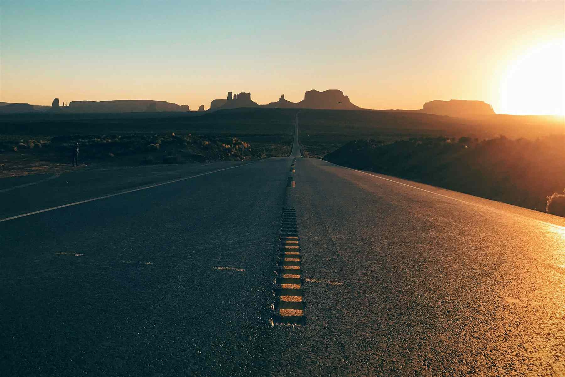
Everything You Need to Know Before Driving in Arizona
Arizona is one of America's great road trip destinations, and for good reason. Vast open highways cut across desert scenery, climb through mountain forests, and wind past towering red rock formations on their way to some of the most photographed landscapes in the country. Between the Grand Canyon, Sedona, Monument Valley, and the national monuments scattered across the state, a rental car and a full tank of gas can unlock an enormous amount of ground.
It's also a state of real extremes. Distances between destinations are longer than they look on a map, weather can shift dramatically with elevation, and some of the most beautiful highway stretches pass through genuinely remote country with little cell service. None of this makes driving here difficult — the roads themselves are excellent — but it rewards a bit of preparation.
This guide covers what to expect: road types and speed limits, seasonal weather and mountain driving, desert safety, wildlife, fuel stops, the state's best scenic drives, and the driving laws visitors should know before they go. If you'd rather enjoy Arizona without navigating unfamiliar roads yourself, Grand Canyon Journeys offers fully private guided tours departing from Sedona, Flagstaff, and Williams, with an expert local guide handling the driving, timing, and route.
Driving Distances Between Arizona's Most Popular Destinations
Arizona is bigger than it looks on a map, and the drive times below assume normal daytime conditions — winter storms in the high country and summer monsoon activity can both add meaningful time to any of these routes.
| Route | Distance | Approx. Drive Time |
|---|
| Phoenix → Sedona | 115 mi | ~2 hours |
| Phoenix → Flagstaff | 145 mi | ~2.5 hours |
| Phoenix → Grand Canyon | 230 mi | ~3.5–4 hours |
| Sedona → Grand Canyon | 115 mi | ~2–2.5 hours |
| Flagstaff → Grand Canyon | 80 mi | ~1.5 hours |
| Williams → Grand Canyon | 60 mi | ~1 hour |
| Sedona → Monument Valley | 190 mi | ~3.5 hours |
| Page → Grand Canyon | 135 mi | ~2.5 hours |
| Page → Horseshoe Bend | 5 mi | ~10 minutes |
| Tucson → Phoenix | 115 mi | ~1.75 hours |
| Scottsdale → Sedona | 110 mi | ~1.75 hours |
| Mesa → Grand Canyon | 235 mi | ~3.75 hours |
These are ideal-conditions estimates. Traffic through Phoenix during rush hour, snow at higher elevations, and monsoon storms in July through September can all add 30 minutes to several hours to a planned route, so it's worth building in a buffer rather than cutting arrival times close.
Arizona Roads Are More Diverse Than Most Visitors Expect
Arizona's road network is more varied than the desert-highway image most visitors arrive with. Interstates 10, 17, and 40 form the state's main arteries, connecting Phoenix, Tucson, and Flagstaff with wide, well-maintained lanes. US highways like 89, 160, and 180 handle most traffic to Northern Arizona's major attractions, while state highways branch toward specific destinations, often narrowing to two lanes.
Beyond the paved network, unpaved forest roads wind through the Coconino and Kaibab National Forests, useful for reaching certain trailheads but better suited to a vehicle with real ground clearance. Scenic byways, several covered later in this guide, are officially designated for their views and almost always worth the extra time. Reservation roads on the Navajo Nation and Hopi Reservation connect some of the region's most striking landscapes and carry their own etiquette, covered below.
Pavement quality is genuinely excellent overall, though visitors should expect mountain switchbacks around Oak Creek Canyon and Jerome, long remote stretches in the north and west, and minimal lighting after dark outside the Phoenix metro area.
Speed Limits in Arizona
Arizona's interstate speed limits reach up to 75 mph in rural stretches, dropping to 65 mph in developed areas and as low as 55 mph through construction zones. Urban streets typically run 35 to 45 mph, residential neighborhoods 25 mph, and school zones enforce a strict 15 mph during posted hours.
Passing zones on two-lane highways are marked with dashed centerlines, and passing outside them, particularly on mountain roads with limited visibility, is both illegal and dangerous. Arizona enforces speed limits aggressively, especially on interstates through open desert where it's easy to drift above the limit unnoticed. Construction zones carry doubled fines, and several stretches, including parts of I-10 near Tucson and Phoenix's freeway system, use photo radar.
Arizona Weather Can Change Quickly
Arizona's size and elevation range mean the weather on any given day can vary enormously between regions, and conditions can shift fast within a single drive.
Summer
Desert heat routinely exceeds 105°F in Phoenix and the lower deserts from June through September, hot enough to cause vehicle overheating on long climbs. Carry extra water, check tire pressure before departure since heat increases blowout risk, and never leave pets or children in a parked car.
Winter
Snow is a real consideration above 6,000 feet, including Flagstaff, Williams, the Grand Canyon's South Rim, Show Low, and the White Mountains, all seeing regular snowfall from November through March. Roads are plowed quickly, but winter tires or all-wheel drive add real peace of mind.
Monsoon Season
From roughly July through September, monsoon season brings sudden afternoon thunderstorms capable of flash flooding and dust storms with near-zero visibility. Washes that are dry in the morning can become impassable by afternoon. Never drive through a flooded wash, no matter how shallow it appears.
Driving to the Grand Canyon
The South Rim is reached via AZ-64 through the gateway town of Tusayan or US-180 from Flagstaff, both fully paved and well maintained year-round. Entrance stations process visitors efficiently outside peak periods, though summer mornings and holiday weekends can bring real delays.
Parking near Grand Canyon Village fills quickly in busy seasons, and the free shuttle system is often faster than hunting for a spot near the rim. Sunrise traffic is generally light, while sunset brings noticeable congestion as everyone converges on the same overlooks. The South Rim stays open year-round, though the North Rim closes seasonally, typically mid-October through mid-May. Arriving before mid-morning remains the best way to beat traffic and crowds.
Driving Around Sedona
Sedona's compact downtown hides a surprising amount of traffic complexity for a town its size. Roundabouts along SR-89A keep things moving more smoothly than traditional intersections once visitors get used to them, but heavy tourism traffic and weekend congestion are a real and predictable part of driving here, particularly from spring through fall.
Parking is limited throughout the busiest areas, and popular trailheads including Cathedral Rock and Devil's Bridge now require timed parking reservations during peak periods, so checking ahead before arrival saves real frustration. Steep roads and switchbacks are common on routes into the red rock formations, and the Red Rock Scenic Byway along SR-179 delivers some of the best views in town at a relaxed, deliberately slow pace. Airport Mesa, a popular sunset viewpoint, sees particularly heavy traffic in the final hour before sunset, so arriving with time to spare is worthwhile.
Mountain Driving in Northern Arizona
Northern Arizona's mountain roads, including the switchbacks through Oak Creek Canyon and the climb to Jerome, involve steep grades that demand real attention, particularly in winter when snow and ice are possible even when lower elevations stay dry and warm. Using a lower gear for engine braking on long descents helps preserve brakes and maintain control, especially in a rental vehicle whose braking feel may be unfamiliar.
Wildlife and fog both add risk on these routes, especially around dawn and dusk, so reduced speeds and extra following distance are worth the small time cost. Checking weather and road conditions before departure, particularly between November and March, is one of the simplest ways to avoid an unpleasant surprise partway up a mountain grade.
Desert Driving Safety Tips
Extreme heat is the defining challenge of desert driving in Arizona — a marginal cooling system or aging tires that would be a minor inconvenience elsewhere can become a serious problem in 110°F heat. Carry more water than seems necessary, keep the fuel tank from running low in remote areas, and check tire pressure regularly, since heat causes it to rise throughout the day.
Cell service disappears entirely on some desert stretches, so downloading offline maps beforehand is a smart precaution. A basic emergency kit — flashlight, tools, first aid — plus sun protection for roadside stops rounds out sensible preparation.
Wildlife on Arizona Roads
Arizona's highways cross through genuinely wild country, and encounters with elk, mule deer, javelina, coyotes, free-range cattle, and even wild horses in some areas are a real possibility, particularly on rural stretches near Flagstaff, Williams, and the Grand Canyon. Elk in particular are large enough to cause serious vehicle damage and injury in a collision, and they're most active, and least visible, during dawn and dusk.
Reduced speeds during these low-light hours, extra following distance on rural highways, and genuine attentiveness near posted wildlife-crossing signs all meaningfully reduce risk. If an animal does appear on the road ahead, braking in a straight line is almost always safer than swerving, which can cause a much more serious rollover or head-on collision.
Fuel Stations and Charging Stops
Gas stations are plentiful in Arizona's larger towns but become sparse across long stretches of Northern Arizona, particularly between Flagstaff and Page, or approaching Monument Valley and parts of the White Mountains. Fill up before departing for the Grand Canyon, Monument Valley, Page, or the White Mountains, rather than counting on finding a station along the way.
EV charging is expanding steadily around Phoenix and along major interstate corridors, but thins out considerably once you leave the metro area, making a gas or hybrid vehicle the more practical choice for a Northern Arizona road trip beyond the interstate system.
Arizona's Most Scenic Drives
Some of Arizona's best experiences happen on the way to the destination, not just once you arrive. These are the state's most rewarding drives.
Oak Creek Canyon
US-89A between Flagstaff and Sedona descends through switchbacks into a forested canyon lined with red rock walls. Drive time: ~45 minutes. Best season: spring and fall. Photography: pull-outs near the switchbacks.
Red Rock Scenic Byway
SR-179 through Sedona is one of Arizona's most photographed roads, passing directly beneath Bell Rock and Courthouse Butte. Drive time: ~20 minutes end to end. Best season: year-round. Photography: pull-outs beneath the formations.
Desert View Drive
This 25-mile stretch along the Grand Canyon's South Rim strings together the park's best overlooks, ending at the historic Desert View Watchtower. Drive time: ~45 minutes without stops. Best season: year-round. Photography: nearly every pull-out is genuinely different.
Historic Route 66
The stretch through Williams, Seligman, and Kingman preserves classic diners and neon signs largely bypassed by the interstate. Drive time: 2–3 hours. Best season: spring and fall. Photography: vintage signage throughout Seligman and Williams.
Apache Trail
This historic route through the Superstition Mountains east of Phoenix winds past Canyon Lake, though sections close periodically for maintenance. Drive time: 2–3 hours when open. Best season: fall through spring. Photography: dramatic desert mountain scenery.
Coronado Trail
US-191 through eastern Arizona's White Mountains is one of the most winding roads in the country, climbing through alpine forest. Drive time: 3–4 hours. Best season: summer and early fall. Photography: high-elevation forest vistas.
Sky Island Scenic Byway
Near Tucson, this route climbs the Santa Catalina Mountains from desert floor to pine forest summit in under an hour. Drive time: ~1.5 hours round trip. Best season: summer, as a cool-weather escape. Photography: dramatic desert-to-alpine transitions.
Driving on Native American Lands
Public highways through the Navajo Nation and Hopi Reservation are open to all visitors and connect some of Arizona's most striking landscapes, including Monument Valley and parts of the route to Antelope Canyon. Speed enforcement on reservation roads is genuine, and posted limits should be respected the same as anywhere else in the state.
Respecting local communities matters here more than on ordinary public roads — these are sovereign nations with their own laws. Photography restrictions apply in some locations, particularly around people, homes, and cultural sites, and permission should always be asked first. Livestock, including sheep, cattle, and horses, may be encountered directly on the roadway, so reduced speeds are worthwhile. Trading posts along these roads offer a genuine opportunity to support local artisans, and road conditions on secondary reservation routes can differ from state highways.
Arizona Driving Laws Visitors Should Know
Seat belts are required for all occupants, and child seats are mandatory for children under 5 or under 40 pounds. Arizona's Move Over Law requires drivers to change lanes or slow down when passing any stopped emergency vehicle, tow truck, or utility vehicle with flashing lights.
Distracted driving laws prohibit handheld cell phone use while driving; hands-free use is permitted. DUI laws are strict, with a 0.08% blood alcohol limit for most drivers and zero tolerance under 21. Headlights are required during rain, and passing a stopped school bus with flashing red lights is illegal from any direction on undivided roads. Four-way stops resolve in order of arrival.
Renting a Vehicle in Arizona
An SUV or crossover with reasonable ground clearance is the most comfortable choice for a Northern Arizona itinerary, particularly if forest roads or winter driving are part of the plan, though a standard sedan works perfectly well for paved highway travel between major towns. Winter considerations matter above roughly 6,000 feet, including Flagstaff and the Grand Canyon's South Rim, where all-wheel drive or winter tires add real peace of mind from November through March.
Unlimited mileage is standard with most major rental companies, worth confirming given the long distances typical of an Arizona road trip. Insurance coverage is worth reviewing carefully, since existing auto or credit card coverage may already apply. Fuel policies vary, with "full to full" generally the most economical option. One-way rentals carry a drop-off fee but remain useful for point-to-point itineraries. Airport pickup is available at every major Arizona airport, with Phoenix Sky Harbor offering by far the widest selection.
Tips for International Visitors
Driving in the United States means driving on the right side of the road, a genuine adjustment for visitors from countries that drive on the left. Distances and speed limits are posted in miles rather than kilometers, so a quick mental conversion (roughly 1.6 kilometers per mile) is worth keeping in mind. Four-way stops, common throughout Arizona's smaller towns, are resolved strictly in order of arrival rather than by any fixed right-of-way, which can feel unfamiliar at first.
Right turns on red lights are permitted after a full stop unless a sign prohibits it. Fuel is typically paid for at the pump by credit card, though stations occasionally require a US ZIP code, in which case paying inside resolves the issue. Most visitors can rent and drive legally on a valid foreign license, though an International Driving Permit is a worthwhile precaution and is required by some rental companies.
When a Guided Tour Makes More Sense
For all the appeal of a self-driven road trip, there's a real case for letting someone else handle the driving. A guided tour removes the parking stress at crowded viewpoints, the need to navigate unfamiliar mountain roads, and the mental overhead of watching for wildlife, weather, and speed limits while trying to enjoy the scenery.
A professional guide brings local knowledge that's hard to replicate from a guidebook — the best photography stops, the quietest viewpoints, timing that avoids the worst crowds. Traveling in a luxury vehicle adds genuine comfort on longer days, and for many, simply not being the one behind the wheel makes for a more relaxing vacation. Grand Canyon Journeys' private guided tours depart from Sedona, Flagstaff, and Williams with door-to-door hotel pick-up included.
Frequently Asked Questions
Is it easy to drive in Arizona?
Yes. Arizona's interstates and US highways are well-maintained and well-signed, and traffic outside Phoenix and Tucson is generally light. The main challenges are long distances between towns, mountain switchbacks in the north, and sudden weather changes rather than the roads themselves.
Do I need an SUV?
Not strictly, but an SUV or crossover with reasonable ground clearance is the most comfortable choice for Northern Arizona, especially if you'll be driving forest roads, visiting during winter, or want extra confidence on Oak Creek Canyon's switchbacks. A standard sedan is fine for paved highway travel between major towns.
Can you drive to the Grand Canyon?
Yes, the South Rim is fully accessible by paved highway via US-180 or AZ-64 through Tusayan, with ample parking at the main visitor areas. The North Rim is reachable via AZ-67 but closes seasonally, typically from mid-October through mid-May.
Is winter driving difficult?
It can be. Flagstaff, Williams, and the Grand Canyon's South Rim sit above 6,000 feet and regularly see snow and ice from November through March. Lower-elevation desert driving around Phoenix and Tucson is rarely affected by winter weather.
Are Arizona roads safe?
Generally yes, with well-maintained pavement and clear signage throughout. The main risks are speeding, driving through flooded washes during monsoon season, and wildlife on rural roads at dawn and dusk, all of which are avoidable with reasonable caution.
What should I carry in my vehicle?
Extra water, a basic emergency kit, a paper map or offline navigation as backup, sun protection, and a phone charger are all worth carrying, particularly on remote stretches of Northern Arizona where cell service and services can be limited.
How far is Sedona from the Grand Canyon?
About 115 miles, roughly a 2 to 2.5 hour drive via Flagstaff, most of it on scenic highway through Oak Creek Canyon and the Coconino National Forest.
Is Route 66 worth driving?
Yes, especially the stretch through Williams, Seligman, and Kingman, which preserves classic diners, neon signs, and small-town charm largely bypassed by the interstate. It's a worthwhile scenic detour rather than a faster way to get anywhere.
Are gas stations common in northern Arizona?
They're common in towns like Flagstaff, Williams, Sedona, and Page, but can be sparse on the stretches between them. It's good practice to fill up before heading toward the Grand Canyon, Monument Valley, or the White Mountains.
Can tourists drive on Native American reservations?
Yes, public highways through the Navajo Nation and Hopi Reservation are open to all visitors. Some side roads and cultural sites require permits or guided access, and photography of people or private property should always be done respectfully and with permission.
Authoritative Sources
For up-to-date road conditions and official travel information, these resources are worth bookmarking before any Arizona road trip.
Skip the Driving, Keep the Adventure
If planning routes, watching the weather, and navigating mountain switchbacks isn't how you want to spend your Arizona vacation, let Grand Canyon Journeys do the driving. Our private tours depart from Sedona, Flagstaff, and Williams, with door-to-door hotel pick-up and an expert local guide handling every mile.
Continue Planning Your Trip
These guides go deeper into the destinations and logistics covered in this driving guide.
Arizona Airports Guide
Compare airports, driving times, and rental car options.
READ GUIDE →Grand Canyon Weather Guide
Seasonal conditions and what to expect year-round.
READ GUIDE →Grand Canyon Travel Planner
Everything you need for a South Rim visit.
READ GUIDE →Sedona Travel Guide
Red rock country and Northern Arizona's ideal home base.
READ GUIDE →Flagstaff Travel Guide
A mountain gateway town near the San Francisco Peaks.
READ GUIDE →Williams Travel Guide
Historic Route 66 and the Grand Canyon Railway.
READ GUIDE →Monument Valley
Towering sandstone buttes along the Arizona-Utah border.
READ GUIDE →Route 66 Arizona
The historic Mother Road through Williams and Kingman.
READ GUIDE →Grand Canyon National Park
Everything to know about visiting the South Rim.
READ GUIDE →